Video | “Google Earth on steroids” gives a boost to urban development
News Audio-Video, News ENAC, News innovation
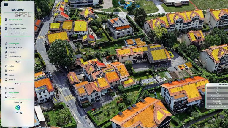
Uzufly’s technology uses aerial imaging to generate 3D models of cities and regions with advanced precision, enabling urban planners to incorporate full-scale designs of all types of architectural and urban structures. Read full article