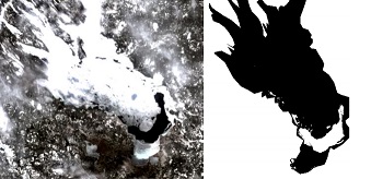
The study of ice formation over lakes is complex. Though a human eye is good at differentiating open water from ice when seeing a satellite image, automatic computation does not always manage to make such classification properly. Indeed, the multispectral data available (for example, for Landsat 8) depends on the characteristics of the local atmosphere, as well as exterior parameters such as the wind speed above water.
A radiometric index coined NILI (Normalized Icy Lakes Index) has been tested with decent results on lake Onego (Russian Federation) at the Geodetic Engineering Lab of EPFL, but it still fails when the ice layer is too thin : its spectral signature can not be distinguished from the one of plain water. Yet, various hints can lead a human eye to understand what is ice what is water, like the presence of rough structures in the ice (cracks) versus the uniformity of the water. Although these differences can not be captured by pixelwise radiometry, image processing techniques (like levellings) can very well retrieve such local information and help the radiometric processes.
The purpose of this internship is to help in the development of full water-ice classification algorithm using both NILI and extra image processing. This includes (but is not limited to) the following tasks:
- Assess the performance of NILI on various Landsat 8 images of lake Onego and its usability on other sample lakes.
- Incorporate mathematical morphology tools (like levellings) in the algorithm to refine the classification.
- Discuss the performance of the algorithm (in terms of accuracy) and its adaptability to different lakes of the world.
Recommended type of project:
Master thesis
Work breakdown:
20% theory, 30% software, 50% experimentation
Prerequisites:
good level in image processing
Keywords:
multispectral images, radiometry, image processing