Photogrammetry consists in creating 3D models out of overlapping photos of an object (this object could be a crop seen by above, a building, a statue…). The 3D position of distinctive features on the object is determined via multiple observations of a set of Tie-points identified and matched in multiple images.
The texture of the object is fundamental for photogrammetry. For instance, it’s not possible to detect tie-points on an object without texture (water, sand), thus it’s not possible to create 3D models of these surfaces with photogrammetry. The goal of this semester-project is to quantify the quality of the texture of different materials (figure 1). Several quality estimators could be studied, for example, the number of tie-point and the precision of the determination of these tie-points in the image. The outcome of this project will permit to determine the precision of the final 3D model.
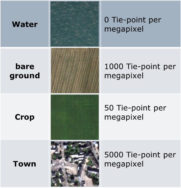
between two consecutive photos for different type of terrains
The steps of this project may vary according to the student preferences:
- Literature review about tie-points detection and matching (SIFT, SURF algorithm).
- Experimentation with photogrammetric software (e.g., pix4D) or with computer vision toolbox (e.g., matlab)
- Statistics on experimental data to draw out general principles (with matlab, python or R)
Recommended type of project:
Semester project (master students)
Work breakdown:
30% theory, 20% development, 50% experiments
Prerequisites:
Familiarity with computer-vision or photogrammetry, data-management with MATLAB, python or R
Keywords:
photogrammetry, computer-vision, image processing, statistics