Field campaign at Dumont d’Urville station
In the framework of the project entitled “Antarctic Precipitation Remote Sensing from Surface and Space” (APRES3) supported by the French and Swiss NSF as well as by the French Polar Institute (IPEV), a first field campaign is organized between November 2015 and February 2016 at the French station Dumont d’Urville in Adélie Land, on the coast of Antarctica.
Christophe Genthon, from LGGE in Grenoble, France, is helping us setting up the instruments before going up to Concordia to look after other instruments dedicated to boundary layer meteorology.
LTE has deployed its X-band polarimetric precipitation radar, as well as a Multi-Angle Snowflake Camera (MASC) and a weighing gauge (Pluvio2 from OTT).
The logistics and field work are very challenging in this cold and windy environment!
You are welcome to follow us at http://epfloutthere.tumblr.com/
Radar
<!–
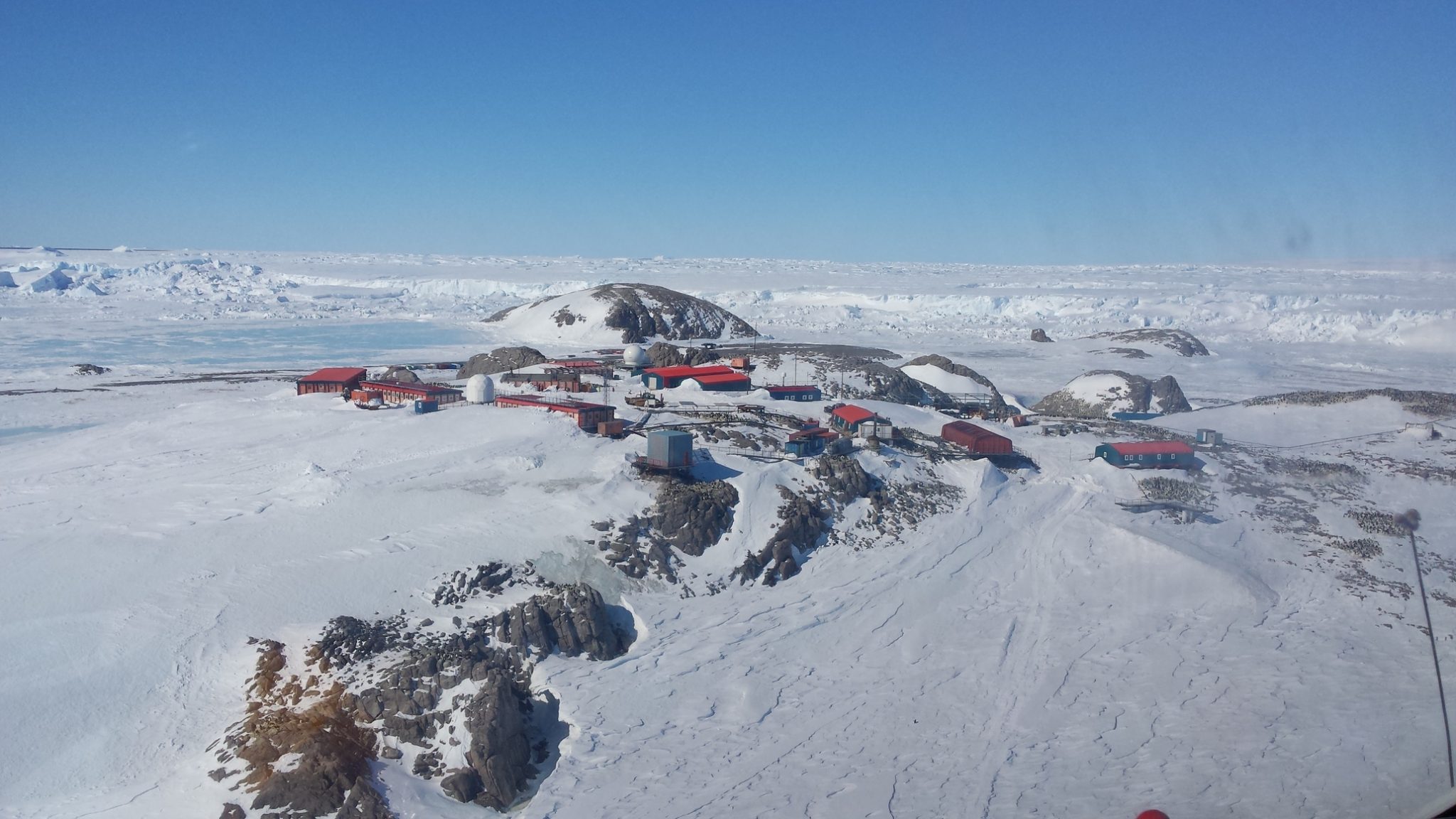
The radar is installed at the DDU base, with a nice view over the surroundings (picture will come soon).
–> <!–
Real-time webcam picture (refreshed every 5 min):

–> <!–
–> <!–

–>
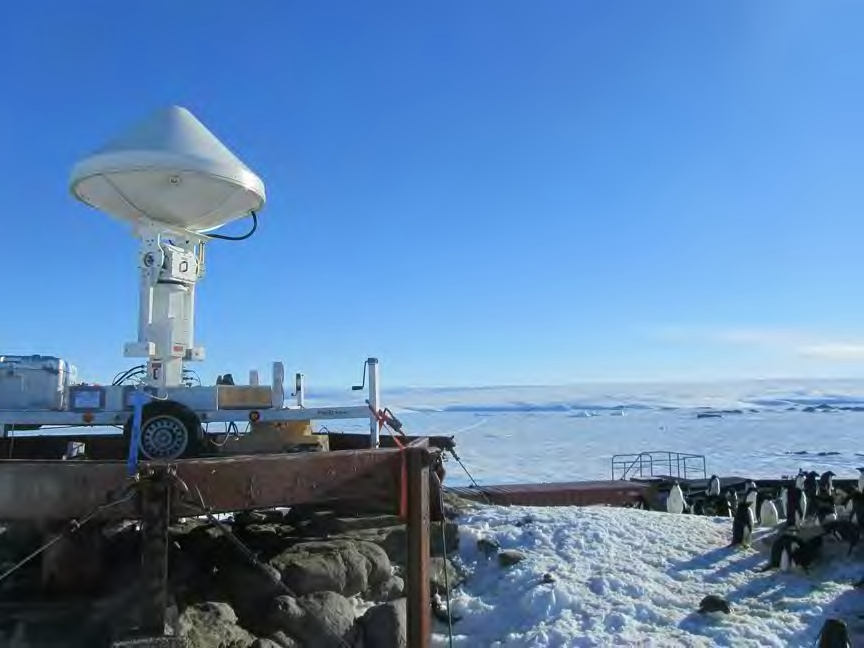
LTE’s radar is installed on the highest point of the Pétrels Island on which DDU is implemented, to have a clear view of the surroundings. The Antarctic ice sheet is visible in the background of the picture below.
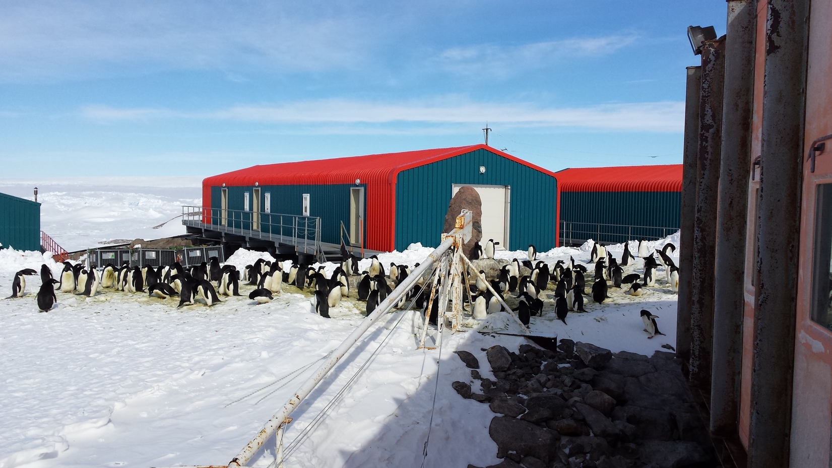
Animals
The island on which DDU is located, is a nested area for Adélie pinguins that stay over every rock free of snow and ice. Even between buildings!