ECOL’s team investigates the spatio-temporal variability of lake surface water temperature (LSWT) and air-water exchange processes, in particular the surface heat flux, from large-scale (satellite-scale) to meso-scale (sub-pixel satellite scale), to small-scale (in situ measurements). The AVHRR satellite data (in collaboration with University of Bern) and weather model results (COSMO) are the main datasets for the former, while a Balloon Launched Imaging and Monitoring Platform (BLIMP) and an autonomous catamaran (called ZiviCat) were developed for aerial remote sensing and in situ measurements, respectively. Engineering at ECOL aims at providing custom technical solutions developed to acquire the data needed for the research activities. Most of these systems are developed in-house by our technical staff.
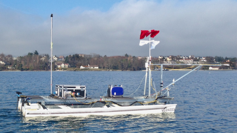
The ZiviCat is an autonomous platform developed at ECOL. It follows waypoints while measuring water temperature at various depths, wind speed and direction, net radiation, etc. It can be monitored remotely using the 4G network or RF communication.
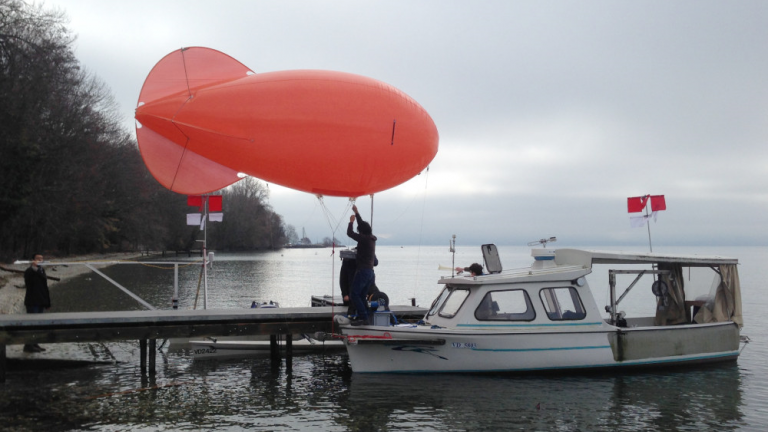
Another equipment is the payload of a tethered balloon that can record thermal and color images from a height up to 2km above ground. The image shows the setting up the tethered balloon with the Zivicat in the background.
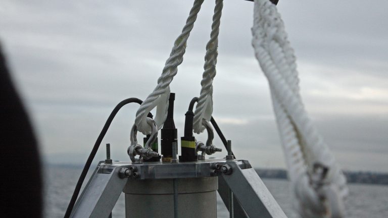
Several underwater systems are also being developed. The current system in the lake consists of a camera and lights. It is used to study the patterns that form on the lake bottom by means of color pictures. Another high resolution device was also developed to monitor the water currents and temperature.
The picture illustrates the lakebed imagery system being readied for a deployment on the lake.
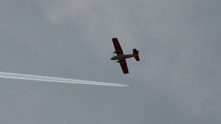
A “My Twin Dream” RC plane was modified to serve as an altitude measurement platform. It carries two cameras, one thermal and one color (RGB).
This drone is controlled via 4G communication and a standard remote control and can be launched from a boat. It can land safely on the water using a parachute.
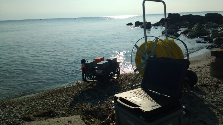
A ROV (Remotely Operated underwater Vehicle) is used to inspect moorings and observe features on the lakebed. It was modified to allow diving 300m deep. Several accessories were integrated such as a depth sounder, grippers, an acoustic positioning system, etc.