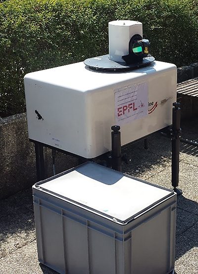
The Doppler light detection and ranging (LiDAR) system is a remote sensing instrument for the wind speed in the atmosphere. It can measure the line-of-sight component of the wind speed along the path of an eye-safe laser beam up to a distance of 3 km away with high temporal resolution. Deployed on the nacelle or on the ground, the Doppler LiDAR is ideal for extended field campaigns capturing the airflow around wind turbines under a variety of atmospheric conditions.
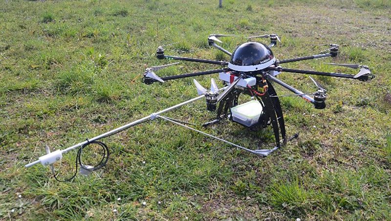
The unmanned-aerial-vehicle (UAV) measurement platform is a remoted controlled G4 Eagle octocopter carrying high frequency 3D wind and temperature sensors. It can hover in the inflow or wake of wind turbines for a limited time providing measurement data that would otherwise require a large meteorological tower.