The morphology and space-time evolution of drainage basins are key features of the Earth’s surface, regulating ecosystem functions and services and creating visually striking patterns across various scales.
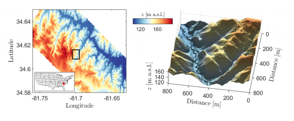
Ridge and valley patterns in a natural landscape. (left) One-meter resolution LiDAR (Light Detection and Ranging) topography of the Calhoun Critical Zone landscape in South Carolina. (right) 3D surface for a subset (black rectangle the left panel) where regular evenly spaced valleys are visible. Data were obtained from the National Center for Airborne Laser Mapping (NCALM) and retrieved from the OpenTopography facility. Modified fromBonetti et al., PNAS (2020).
At CHANGE, we combine topographic data analysis with numerical modeling and analytical approaches to study: i) the formation of ridge and valley patterns, ii) land degradation and soil erosion processes, iii) the coevolution of soil, vegetation, and topography.
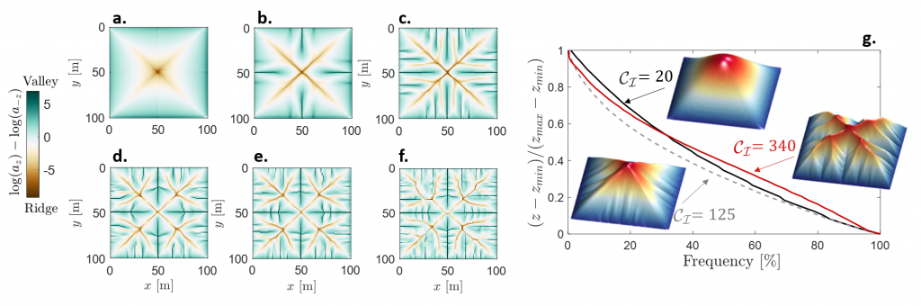
(a-f) Modeled ridge and valley patterns obtained for different ratios of runoff erosion to soil creep (encoded in the channelization index). Brown corresponds to ridges and green to valleys. (g) Normalized hypsometric curves obtained for values of the cahnnelization index equal to (solid black), 125 (dashed gray), and 340 (solid red). When no secondary branching is observed (i.e., CI≲155), the hypsometric curve is concave, while after the first secondary branching is formed it undergoes a transition to a shape concave for higher elevations and convex at low elevations. Insets show 3D plots of the steady-state topographies for the 3 cases where the color code represents surface elevation (red, high; blue, low). Modified fromBonetti et al., PNAS (2020).