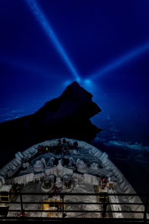
Picture by. S. Svarvarsdottir.
It is not as easy as it sounds: Get an icebreaker, go up to 88 °N in winter, exchange scientists, crew and cargo and return. Job done.
Actually, going through the Arctic winter ice in February that far north is rather unusual. This means that there are also not many icebreakers, which are equipped to travel through several meter thick sea ice. We are traveling with the Kapitan Dranitsyn, an Arc 7 class ship, which can go through 1.3 m thick ice. To reach Polarstern, our MOSAiC research vessel, we know that we need to cut through first and second year sea ice, which can easily be thicker than 1.3 meters. And even thinner but highly wind-compacted ice with ridges can already pose challenges. So what is the strategy to reach our destination and how are we doing?
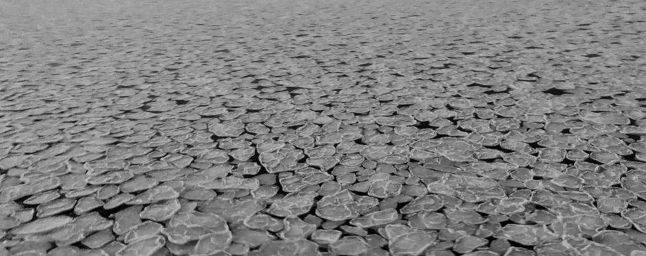
For the first part of the way, we headed towards Franz-Josefs-Land through freshly formed ice with about 13 knots, which does not pose a challenge to the Dranitsyn. This was mostly so-called pancake ice (see picture). North of Franz-Josefs-Land the wind has pushed the ice away, further north, creating a polynya. Polynya refers to a large open water area in the sea ice and is often associated to winds blowing off land. The water was also freshly frozen. This time no pancakes formed, but the thin, level ice was decorated by myriads of frost flowers. Those are beautiful and we were lucky to travel almost 24 hours through this extended area with almost full moon. The sun is not rising anymore in these latitudes at this time of the year, but there is a sense of dawn on the horizon.
The second part of our journey has so far been characterized by first year sea ice. Leaving the polynya, we found it to be quite compacted and heavily ridged, and with a decent layer of snow on it. In such conditions, the Dranitsyn often gets to a hold, needs to back up and pick a track next to the original. This is time consuming and rather bumpy. You have to get used to it, if you want to get some sleep. On the lower decks towards the outside, we hear the walls of the ship “screaming” when the ice scratches along it, it’s resembling the shredding of heavy steel.
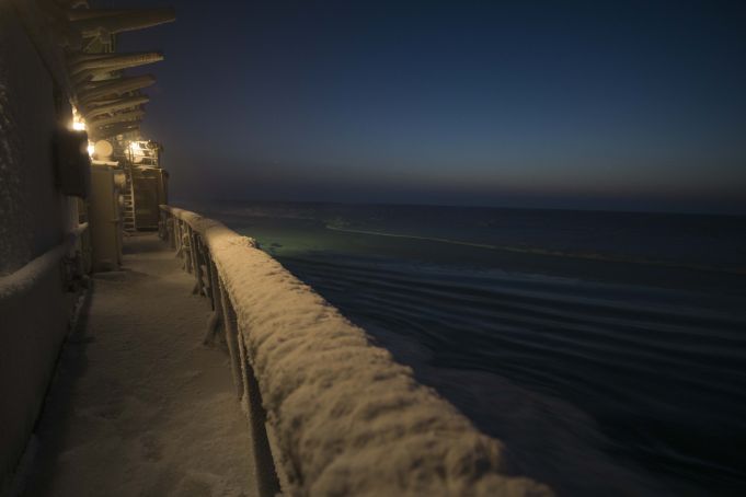
Since this mode of travel consumes a lot of energy and is slow, the idea is to look for leads. Leads are open areas in the ice, wider than a crack, through which the ship can easily travel without breaking ice (see picture). To find those, we have an ice navigator on board who intensively studies high resolution satellite imagery to design a track through the next 400 km towards Polarstern. The challenge is that even very recent images, e.g. from the last 24 hrs, might not reflect the ice conditions anymore. Wind can compact the ice very quickly, tides – particularly during full moon – break or compact the ice as well. After all, this is a game of experience, persistence and patience.
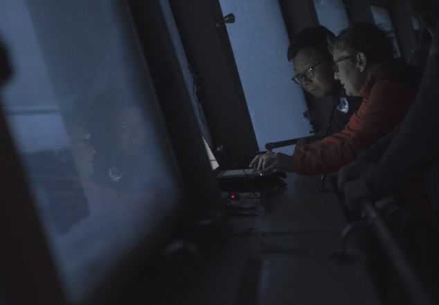
There is a lot for everyone on board to learn about sea ice. One of our colleagues has initiated an ‘ice watch’ around the clock (see picture). At each hour, sharp, a small team gathers on the bridge to note down the local observations. This includes sea ice coverage, type, thickness, weather condition, pictures and information on the engine power. The idea is that this detailed information is matched with satellite data to optimize information retrieval from the remote sensing products. Ice charts for the winter time Arctic are still somewhat crude. And while travelling through this dark maze of ridges on compacted floes, we clearly see the value of this.